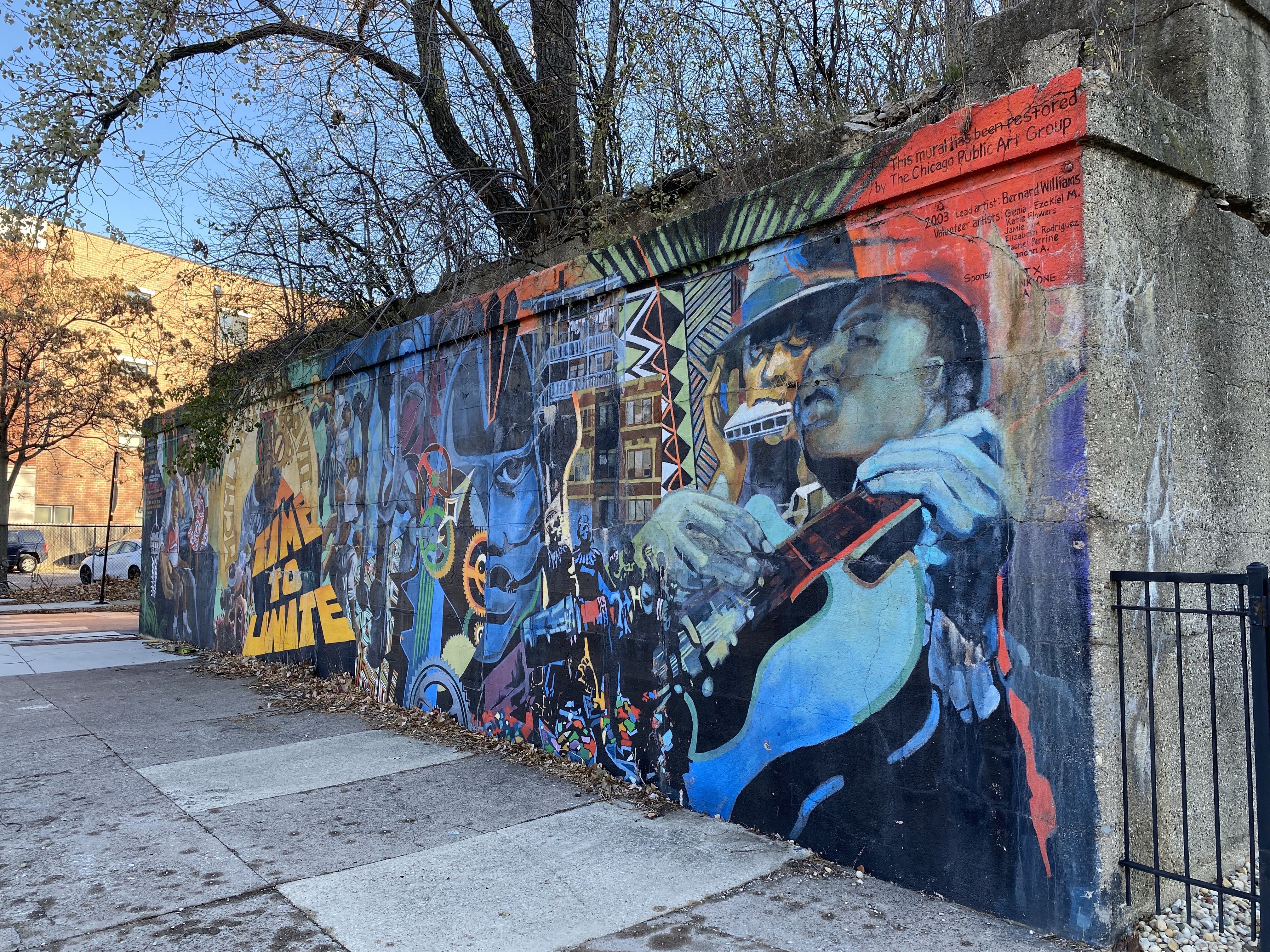
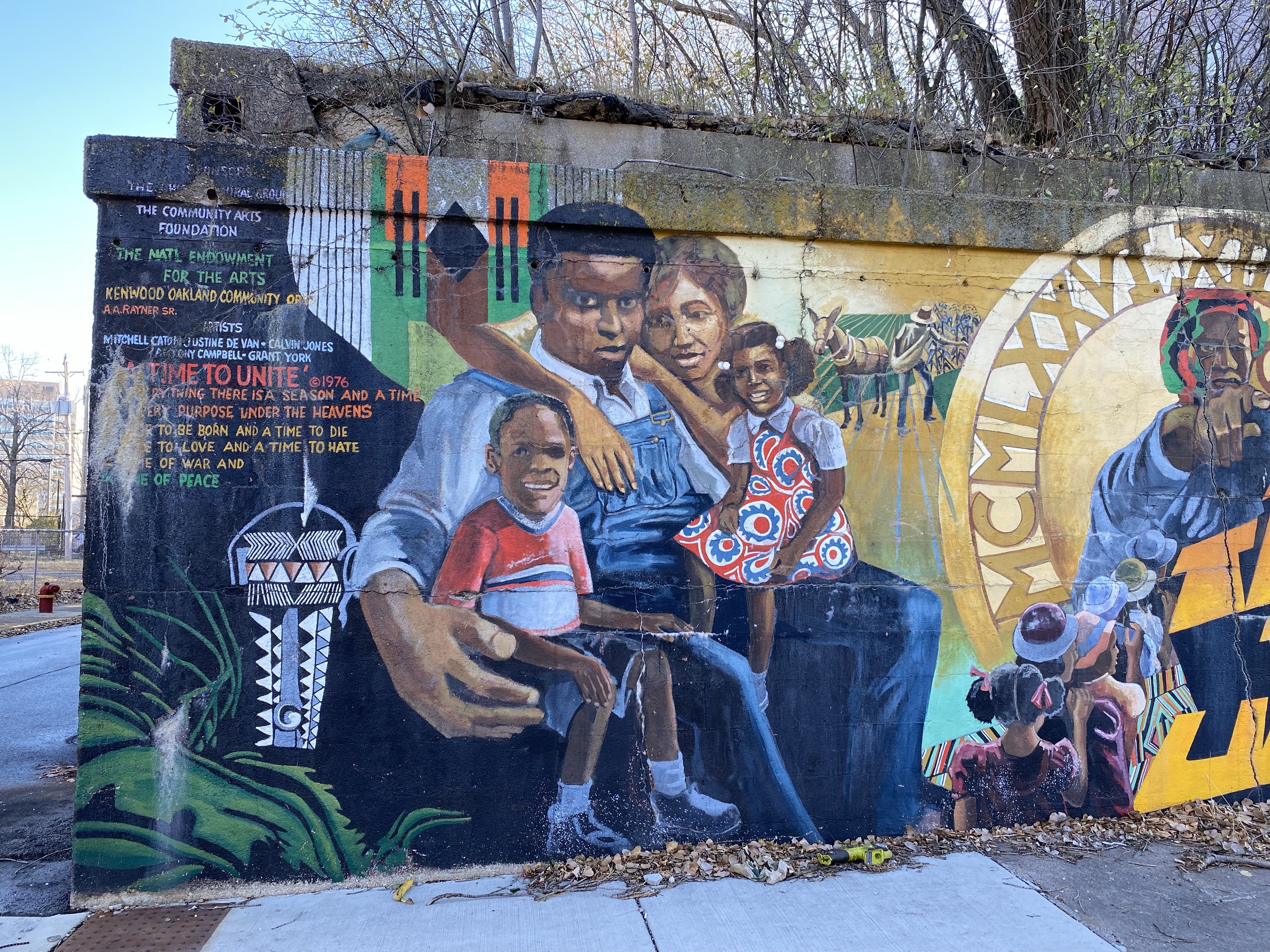
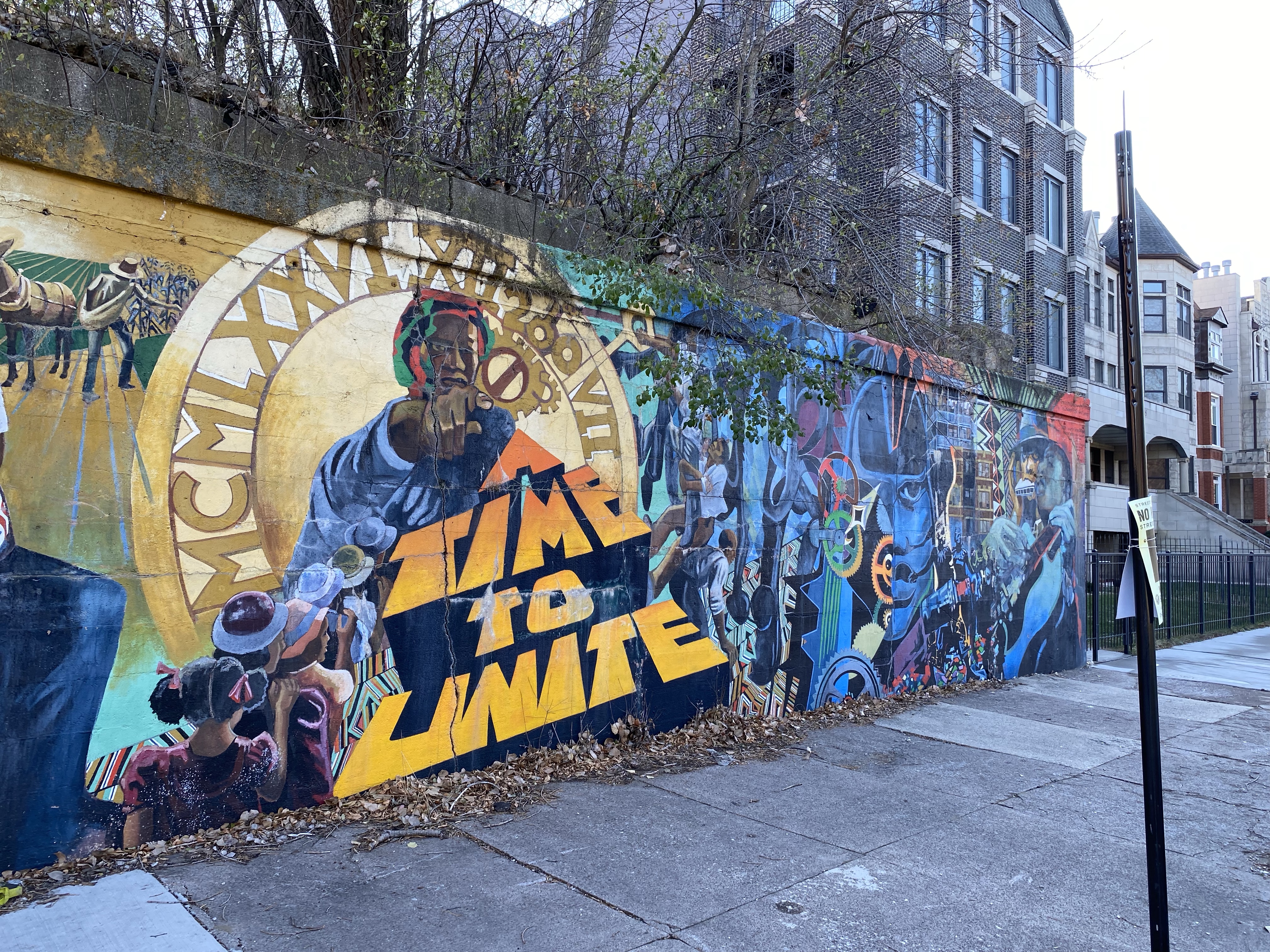
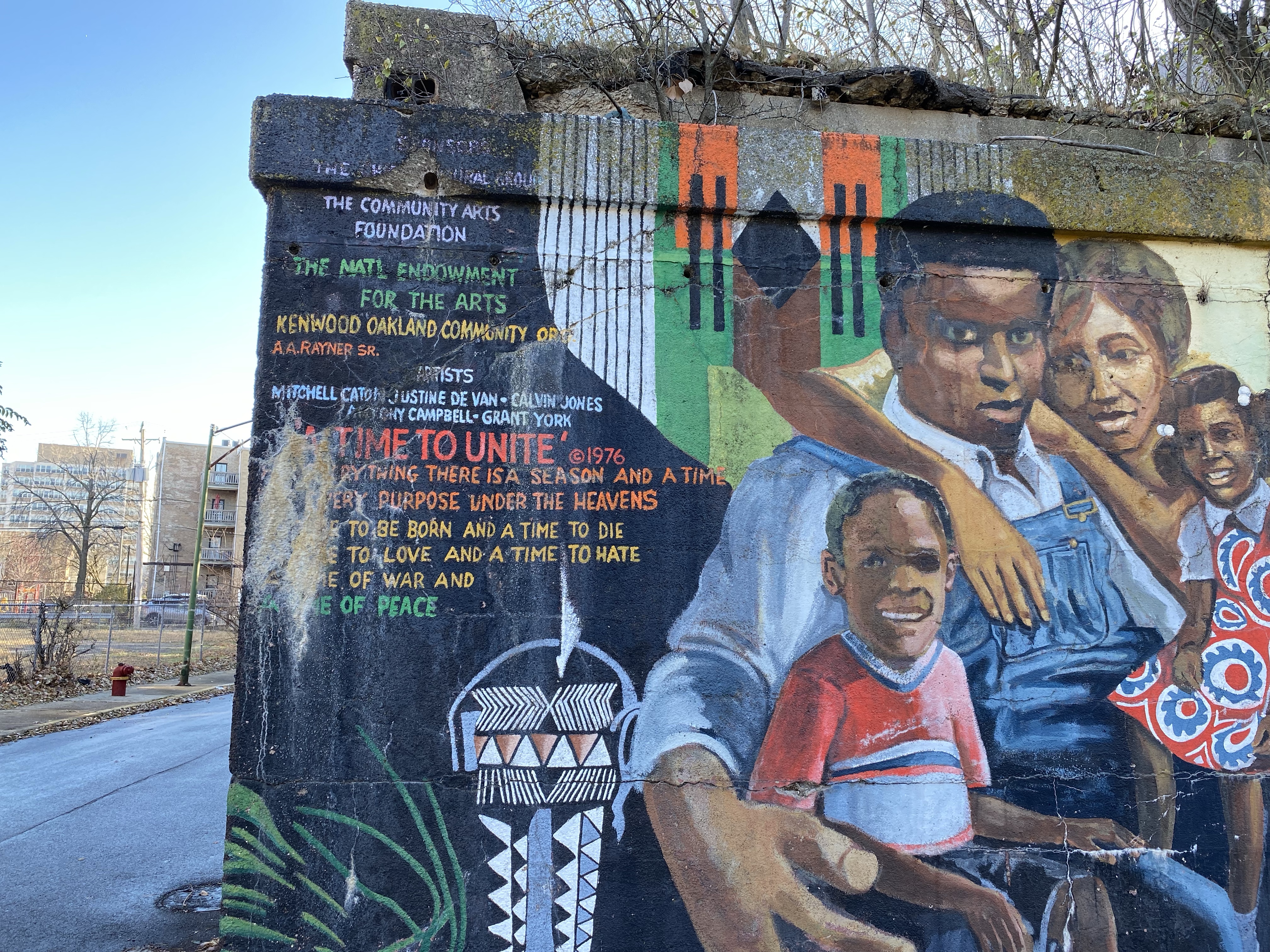
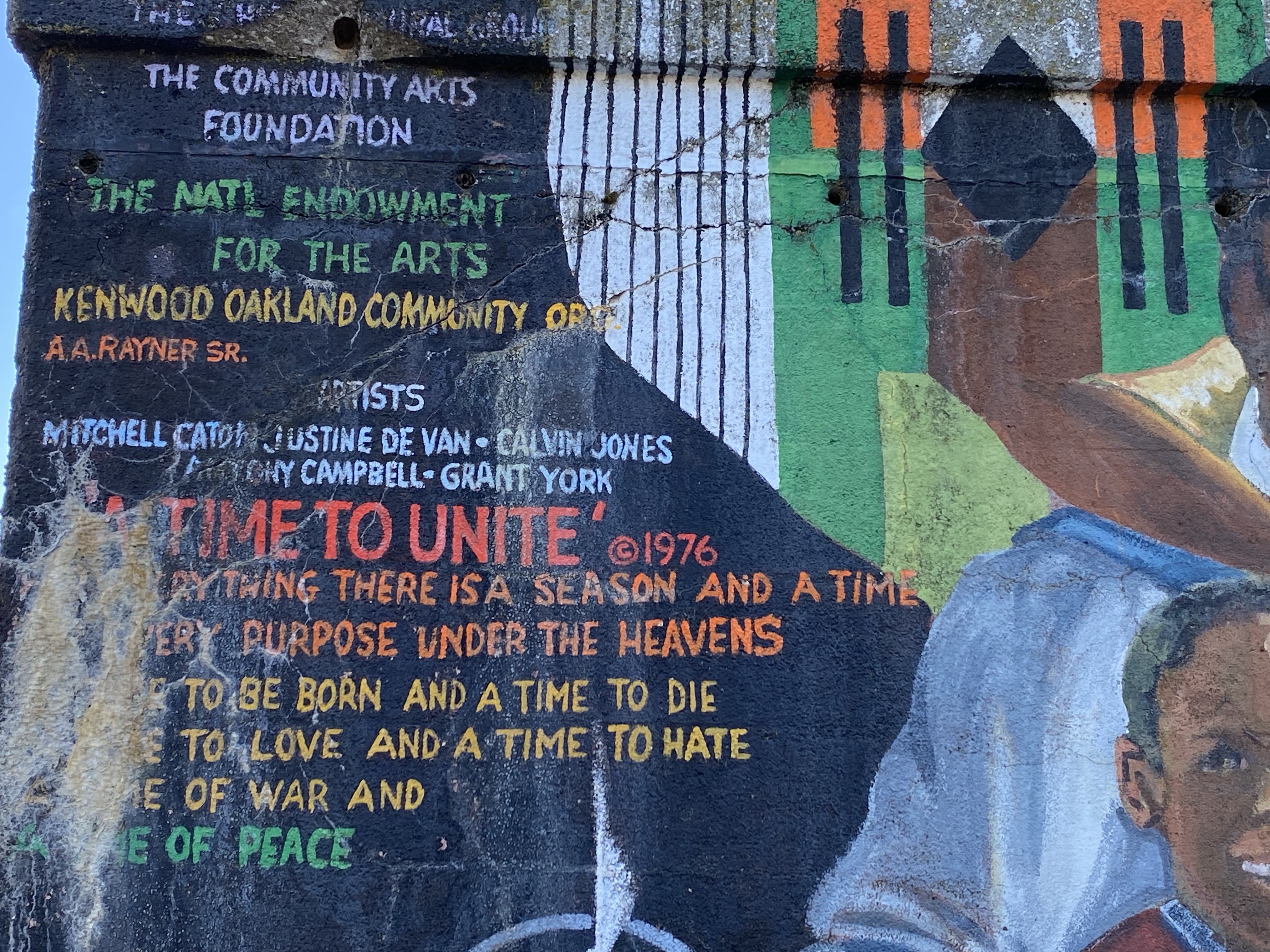
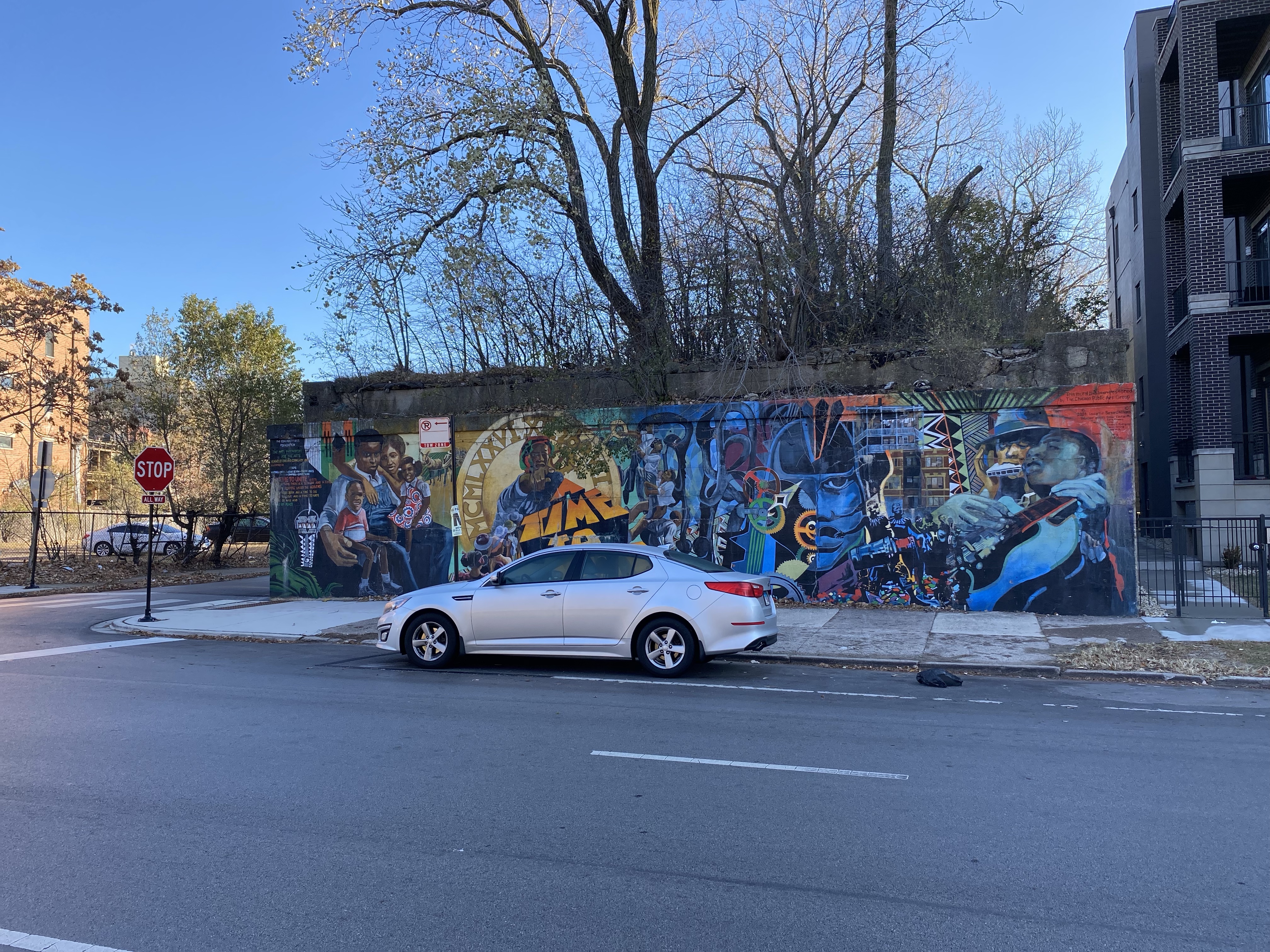
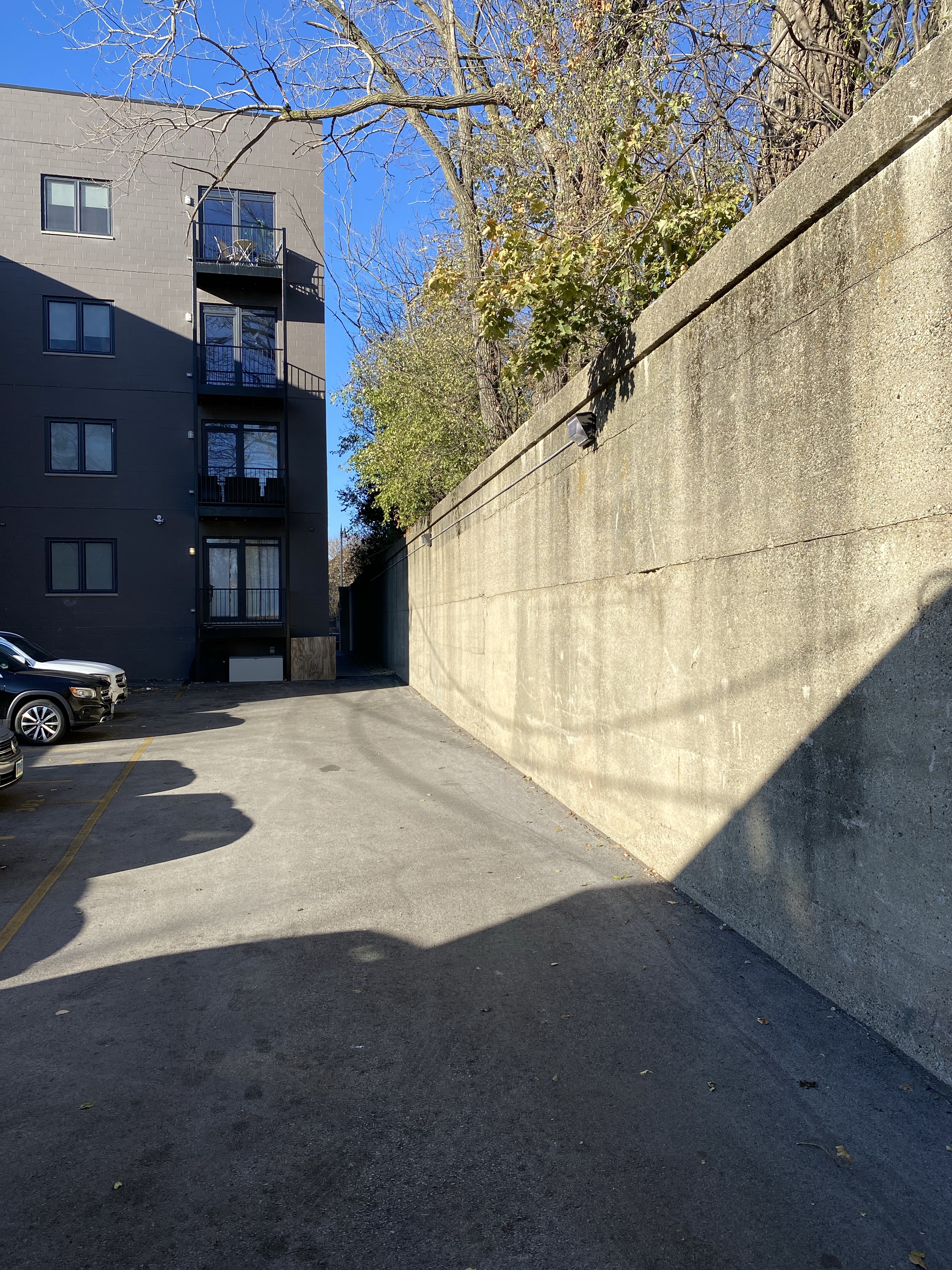
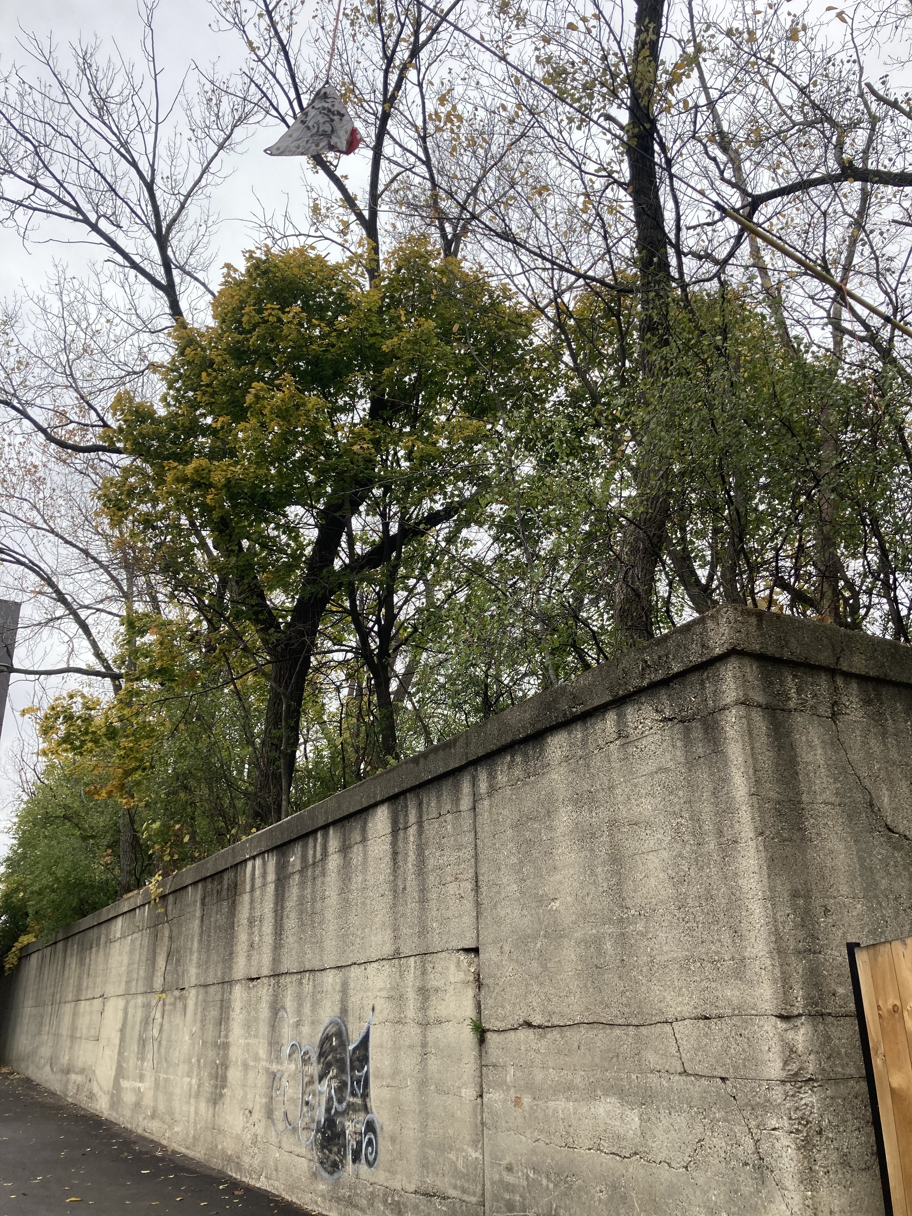
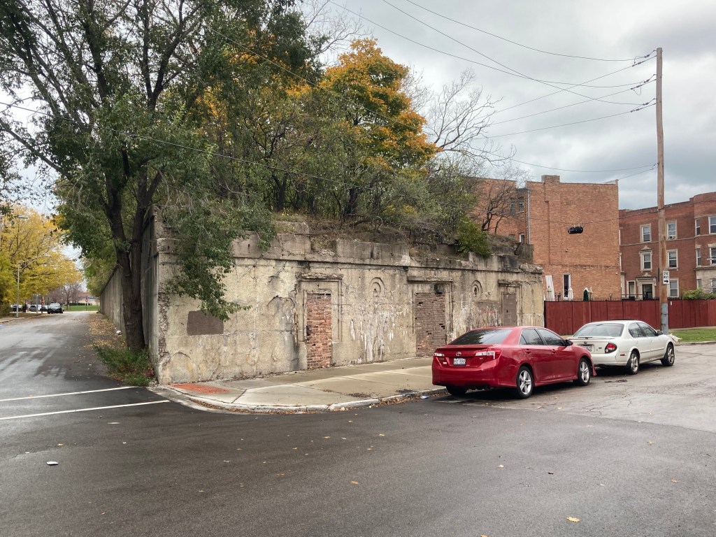
About 13′ tall, 52′ wide, and 430′ in length, its area being approximately 22,360 square feet, this part of the embankment is between Drexel Blvd and Ellis Ave. Its north wall faces 41st St and its south wall, an alley and an apartment building on Drexel Blvd. There is a mural on its Eastern Wall of Drexel Blvd.
According to https://www.chicago-l.org/operations/lines/kenwood.html the Chicago Transit Authority closed the embankment for public use (Kenwood Branch) in 1957 but the Chicago Junction Railway continued using it for commercial purposes until the 1960s.
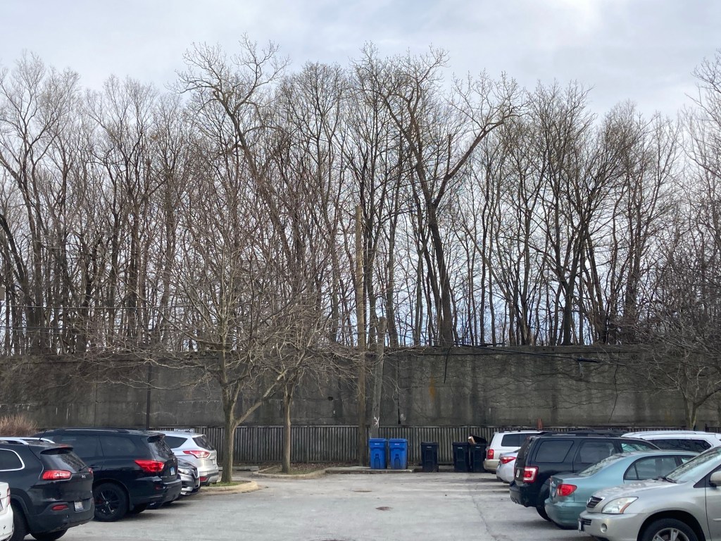
The CJRE is about one mile long and it is located in the Kenwood neighborhood of Chicago’s south side. It is visible mostly along 41st Street, running from South Lake Park Ave, which is close to Lake Michigan, to highway 90/94. Some sections of it no longer exist and a forest has grown on top of it. Below is a video of this section of the CJRE and some photographs.
Aerial view from Google maps of the Chicago Junction Railway Embankment from Lake Park Ave to Drexel Blvd
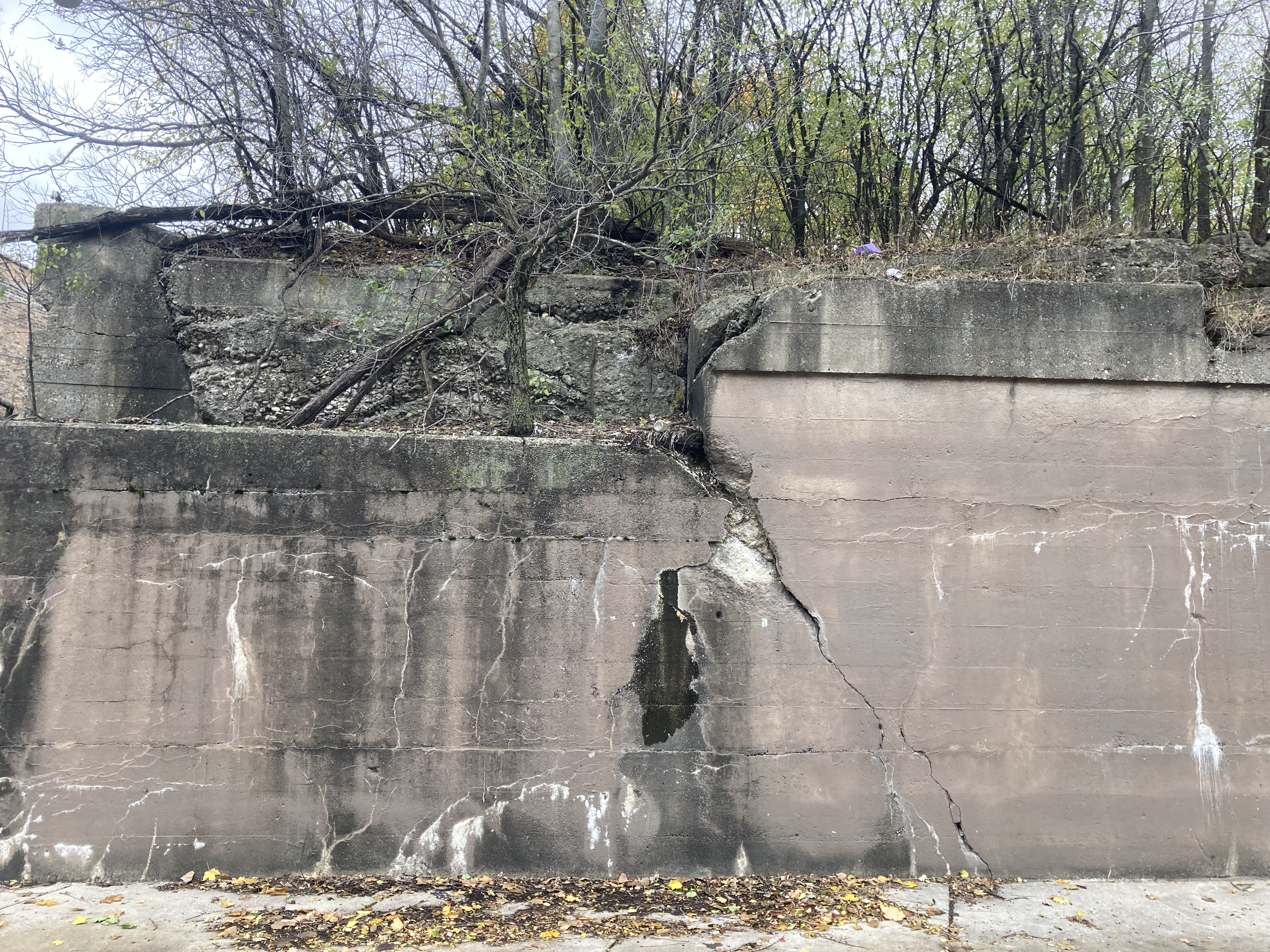
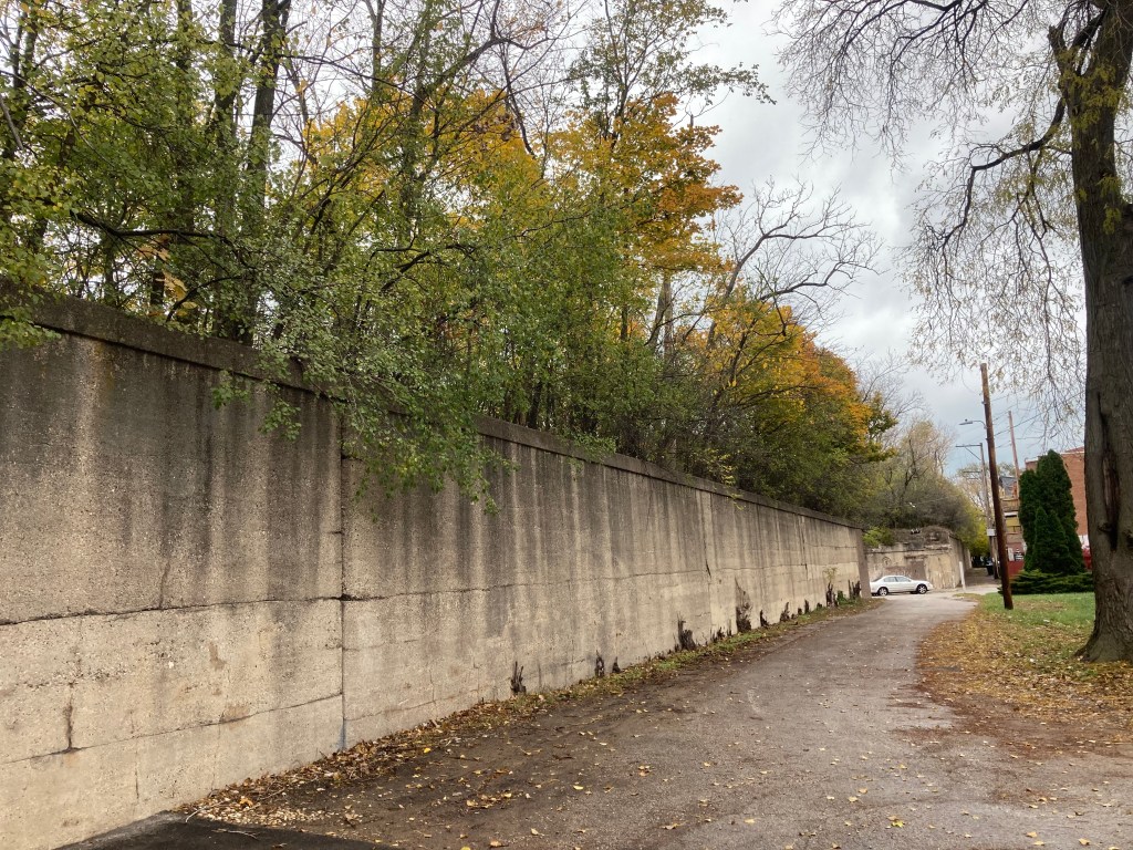
MINUTE 2:55 is where you can see the section of the CJRE between Ellis Ave and Drexel BlvdThe Mural on Drexel Blvd, view from its south sideSome of the residents of this building have a good view of the top of the embankmentBeautiful alley between this building and the embankmentNorth wall of the embankment on 41st Street, on the south side of the street.Alley and parking lot, behind Drexel Blvd Alley, south wall of the embankmentWest wall on Ellis AveSouth west wall, Ellis AveClose up, upper west wall, Ellis AveUpper part south wall 41st St alley, north of 42nd PlSouth wall alley
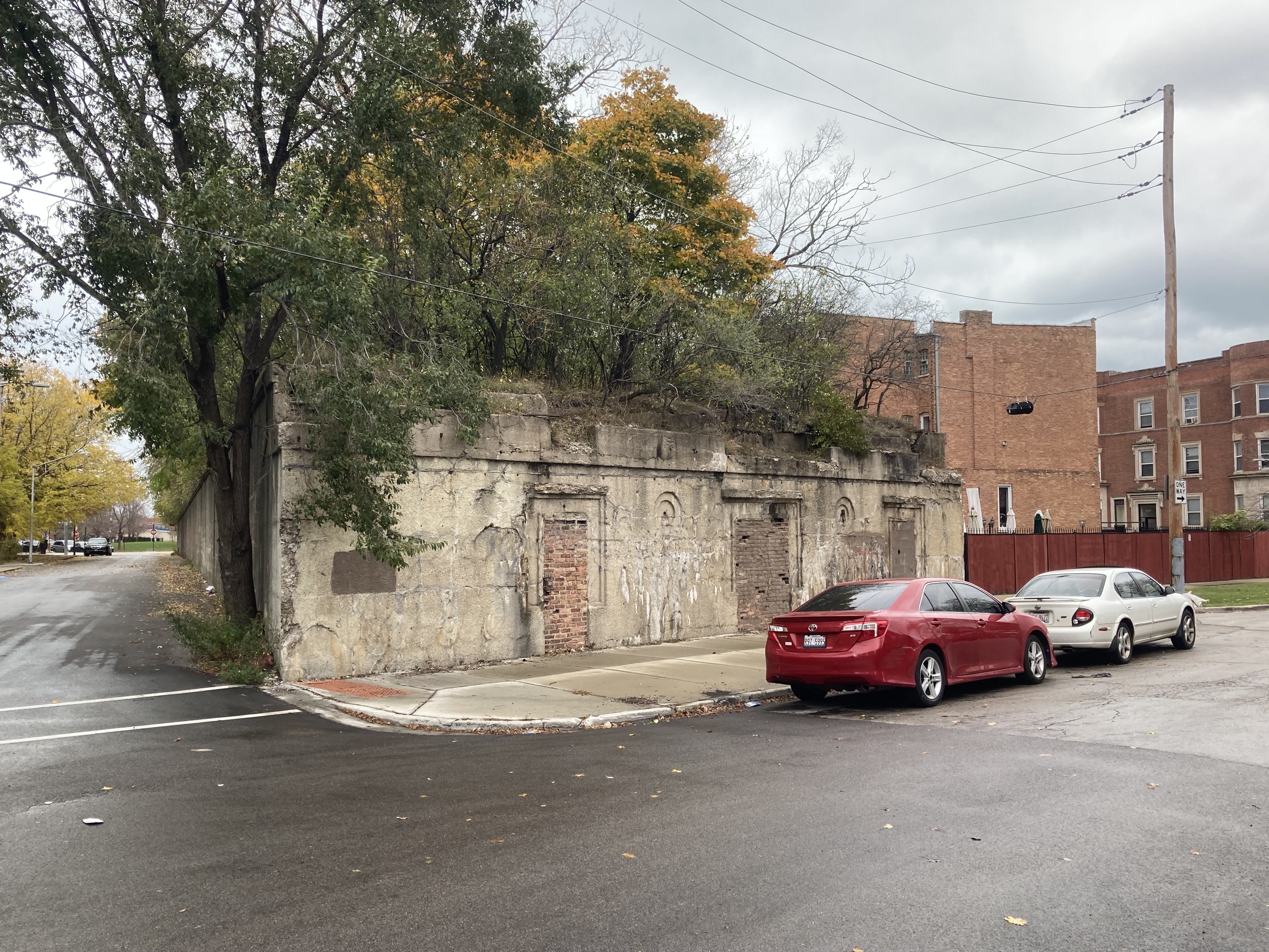
About 400′ long, 52′ wide, (20,800 sq. feet approx) and 13′ high, the abandoned Ellis & Lake Park Station is located between 41st Pl and 41st St, and between Lake Park Ave and Ellis Ave, and it is about a third of mile from Lake Michigan. The entrances on both Lake Park and Ellis are sealed. The 42nd Place station, which can be seen on the map below, and which was the closest to Lake Michigan no longer exists. You can see a 1955 photo of the station here.
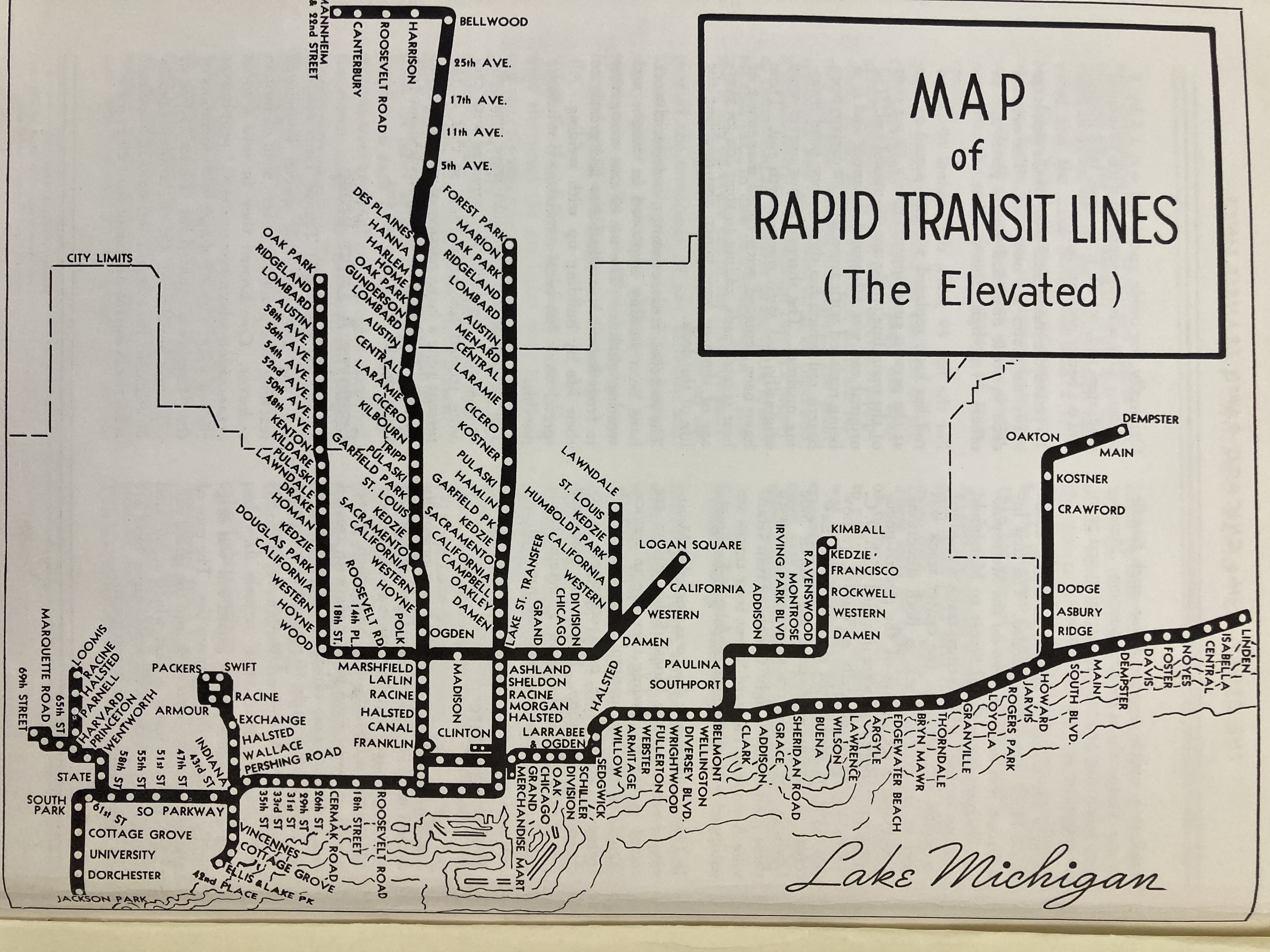
1940 map of the Kenwood Branch, from Chicago Public Library
The Ellis & Lake Park Station, Lake Park Avenue EntranceAerial Google map of the Ellis & Lake Park elevated train station between South Lake Park Ave & S Ellis Ave. Many of the buildings have a view of the top of the embankmentThe abandoned Ellis & Lake Park Station, Lake Park entrance, corner of 41st St, west side of Lake Park AveThe abandoned Ellis & Lake Park Station, Ellis Ave entrance, west side of Ellis Ave, just south of 41st StreetWalled up door of Ellis & Park Ave StationSouth wall, between 41st street and 41st place
Ellis and Lake Park Station South Wall, 41st Street alley
The Chicago Junction Railway Embankment (CJRE) is in the Bronzeville and Kenwood neighborhoods. It used to be part of the elevated train system and it was closed to the public in 1957. The CJR Kenwood branch had six train stations of which only three exist today. It is about 1 mile long from Lake Park avenue to the Dan Ryan highway. There’s a small section of it that heads north and descends to ground level, from 40th Street to Pershing Road, and is West of Federal street. Some sections of the embankment, along with its train bridges, are still visible on the west side of the Dan Ryan, all the way to South Normal Avenue.
The Chicago Junction Railway Embankment on Google Maps, outlined in yellow
According to the city of Chicago, the embankment is owned by the Cook County Land Bank Authority. I contacted them several times by phone and email with many questions, for example, what their plans are for the embankment, if any part of it is for sale, if they do any maintenance and if I can get a permit to walk on it and take pictures, but I have not received a response.
1940 Elevated Public Transportation train map Chicago from Chicago Public Library1940 map of the Kenwood Branch, from Chicago Public Library
I love the majestic walls of the Embankment and the thick forest with several hundreds, if not thousands, of trees and shrubs that have grown on it. I find it fascinating how these trees and shrubs have grown on their own, although this is not uncommon in Chicago, due to our rich soil and abundance of water.
From some of the photographs I sent to the Morton Arboretum, Ms. Julie Janoski, Plant Clinic Manager there, has identified several species present on top of the CJRE to be green and white ash trees, Norway maples, Tree of heaven, Siberian elms and alders.
A south wall section of the Chicago Junction Railway Embankment, west of Ellis Ave. Part of the Ellis & Lake Park train station entrance is visible where the car is parked
The Ellis and Lake Park Station on Lake Park Avenue & 41st Street
Old bridges over Federal Street
Mural on Cottage Grove, between 41st & Bowen Ave
Our Lady of Africa Church parking lot on Oakwood Blvd
Ms. Scott added that there’s probably also “mulberry, box elders, honeysuckles and likely other (weedy) species.”
From a layman’s perspective, I know having so many trees in our city reduces carbon dioxide, increases oxygen, and preserves some biodiversity in our city. Trees are of course also relaxing and beautiful to look at.
If you would like to see some videos of the CJRE, you can do so at my YouTube Channel.
In the near future, I will be publishing many descriptions, photos and videos of the CJRE in this blog. Here’s an index that will be linked with hypertext: